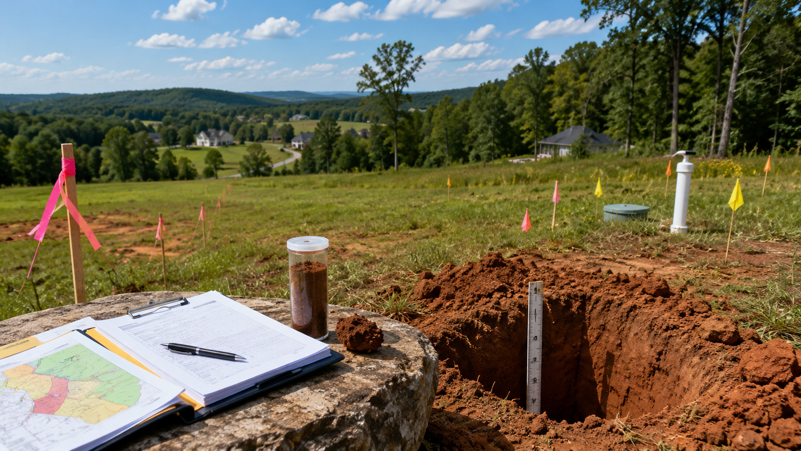
Cherokee Parcel Buildability Review • Legal → Physical → Financial → Permit Gate
Buying Land in Cherokee County: Zoning, Soil Tests, Septic and Permits
A tract that looks buildable on paper can still fail you on jurisdiction, access, septic capacity, drainage, grading, utility distance, or permit sequencing — and most buyers don’t find that out until it’s expensive to fix. This field guide walks you through investigating the parcel properly before your due-diligence deadline runs out.
Last reviewed: July 28, 2026
We went through Cherokee County Planning and Zoning, GIS, Development Service Center, Engineering, Stormwater, and residential permit guidance; North Georgia Health District septic information; Georgia Department of Public Health onsite-sewage rules and manuals; and Cherokee County Water and Sewerage Authority resources to put this together. Requirements still depend on the parcel, jurisdiction, road ownership, proposed home, and current agency review — always confirm against your specific situation.
Buying Land in Cherokee County: Quick Answer
Don’t buy Cherokee County land just because the listing says “residential,” “perc tested,” or “utilities available.” Those three words get thrown around a lot more loosely than buyers realize. First identify the governing jurisdiction, get the zoning district and dimensional rules in writing, confirm legal access, commission an appropriate boundary and topographic survey, and figure out whether the intended house, driveway, well or water connection, and septic system actually fit together on the same usable portion of the tract.
Treat septic feasibility as a design problem, not a yes-or-no label. The soil evaluation, proposed bedroom count, absorption area, replacement area, setbacks, slope, groundwater, rock, drainage, and final Environmental Health review all have to work together as one system. A prior report can be useful evidence, but it shouldn’t replace confirmation for your exact building plan — soil reports are matched to a specific house, not a lot in general.
Make sure the contract gives you real due-diligence time and access for zoning, surveying, soil evaluation, utilities, driveway review, flood and stream screening, preliminary site planning, title review, and estimates. The purchase price is only one line item in the actual land budget — a lot of buyers learn that the hard way.
Buying Land in Cherokee County: The Three-Gate First Pass
A parcel really needs to pass all three gates, not just one or two. Buyers often fall in love with a floor plan before confirming the lot can actually support it — that order of operations causes a lot of heartache. An early preliminary site plan can expose conflicts among setbacks, driveway geometry, septic areas, buffers, slopes, and the building footprint before you’re financially committed.
1. Identify the Jurisdiction Before Reading the Zoning Code
A Cherokee County mailing address doesn’t automatically mean the parcel is governed by unincorporated-county rules — this trips up more buyers than you’d expect. City limits and annexations genuinely matter here. Cherokee County’s Development Service Center permits construction in unincorporated Cherokee County and the City of Waleska. Parcels inside other incorporated municipalities may follow that city’s own zoning, development, and permitting process instead.
Start with the county GIS parcel, city-boundary layer, tax record, and recorded deed. Then contact the planning or zoning office that actually has jurisdiction and get written confirmation. Don’t rely on a real-estate portal, a postal city, a school assignment, or the seller’s word to decide which ordinance controls — get it in writing from the source.
2. Zoning Answers More Than “Residential or Not”
Cherokee County explains zoning through use, density, setbacks, and lot size. For a land buyer, those categories turn into very practical questions: Is one detached home allowed by right? Is the parcel actually large and wide enough? Where are the front, side, and rear setbacks measured from? Are accessory buildings, livestock, a home occupation, short-term rental, or a second dwelling allowed? Does a special use, variance, rezoning, or subdivision action look necessary?
A zoning designation alone doesn’t certify buildability — that’s worth repeating because so many buyers assume it does. A compliant use can still get blocked by access, septic, buffers, floodplain, lot shape, easements, topography, or a recorded private restriction. Keep the zoning answer in the same file as the survey and preliminary site plan so every professional you hire is working from the same parcel assumptions.
3. Read the Deed, Easements, Access, and Private Restrictions
The county’s approval process does not replace title work — those are two completely separate tracks. A closing attorney should review the deed, legal description, recorded plat, easements, covenants, liens, access rights, and any road-maintenance agreement. Confirm the parcel has legal access to a public road or a recorded private access route that’s actually sufficient for the intended home, utilities, emergency access, construction traffic, and future resale.
Look for utility easements, shared driveways, ingress limitations, transmission corridors, access obligations, conservation restrictions, and covenants that are stricter than zoning. Private restrictions can limit home size, materials, animals, rentals, or subdivision even when public zoning would otherwise allow them — the deed can be stricter than the county.
4. Commission the Right Survey for the Decision
A tax map is a screening tool, not a construction plan — don’t confuse the two. Ask a Georgia land surveyor what work actually fits your situation for boundaries, topography, easements, encroachments, frontage, flood information, streams, utilities, and a proposed house location. Irregular tracts often need more field work than a tidy recorded subdivision lot would.
Topography matters because acreage and usable acreage are genuinely two different numbers. Steep slopes can lengthen a driveway, increase grading, require engineered walls, complicate septic placement, and change drainage. Walk the property after a rain if you possibly can — you’ll see things a dry-day walk never shows you. Look for channels, wet areas, exposed rock, fill, old roads, dumping, sink-like depressions, eroded banks, and water moving in from neighboring land.
5. Soil Tests and Septic: Protect the House Site and the Replacement Area
Above ground
The survey and preliminary layout must fit the house, driveway, setbacks, well or water line, stormwater flow, primary absorption area, and a protected replacement area.
Below ground
Soil characteristics, seasonal groundwater, rock, restrictive layers, slope, and absorption conditions influence whether a conventional, alternative, engineered, or no practical system is possible.
The North Georgia Health District requires permits before installation of a new onsite sewage system, and before additions, modifications, or repairs. Cherokee County residential-permit guidance directs applicants to Environmental Health before applying for the building permit when septic is involved. Georgia’s onsite manual also requires onsite soil analysis to validate soil data before construction permits are approved or denied — this isn’t a step you can skip.
Ask whether an existing soil report is current, complete, prepared by an appropriately qualified professional, and actually matched to your exact parcel and proposed bedroom count. Verify the report with Cherokee County Environmental Health directly. A bedroom increase can increase design flow and the land area needed. Moving the house or driveway later can eat into an area the septic design expected to stay undisturbed — plan the whole layout together, not piece by piece.
Don’t clear, fill, cut, trench, or drive heavy equipment across a proposed septic area just to “prepare” the lot — this is a genuinely common and genuinely expensive mistake. Site modification can alter the conditions that supported approval in the first place. The safest sequence is evaluation, concept layout, agency coordination, and only then approved site work — in that order, every time.
6. “Utilities Available” Must Become Written, Address-Level Answers
Contact Cherokee County Water and Sewerage Authority for service information in unincorporated Cherokee County, and contact the applicable city or provider when the parcel sits inside another jurisdiction. Ask whether water and sewer are actually available to the parcel, where the nearest facilities are located, whether capacity and connection are genuinely available, and what extensions, easements, meters, taps, or off-site work might be required.
A visible water line does not prove a connection is approved or affordable — seeing a pipe doesn’t mean it’s yours to tap into. “Sewer nearby” can still involve elevation, easement, capacity, or extension problems that add up fast. Where public water isn’t available, investigate well siting, septic separation, water quality, power, storage, and drilling risk with qualified professionals before you count on it working out.
Get extension estimates for electricity and communications too. Long runs, road crossings, transformers, rock, and private easements can change the budget more than people expect.
7. Confirm the Driveway Before Fixing the House Location
Cherokee County residential-permit materials list an approved driveway permit when applicable. County guidance specifically identifies driveway permits for lots connecting to county-owned rights of way without curb and gutter. An entrance on a state route may require Georgia Department of Transportation review, not just a county-only answer — that’s a distinction worth knowing early.
The driveway genuinely has to work in three dimensions, not just as a line on a survey. Evaluate frontage, sight distance, grade, culvert and drainage needs, turning space, emergency access, construction-truck movement, and the actual route to the garage. A cheap house pad can quietly get offset by an expensive driveway cut, bridge, major culvert, long retaining wall, or excessive paving length — the driveway is often where the real money goes.
8. Screen Floodplain, Streams, Buffers, Wet Areas, and Drainage
Cherokee County provides floodplain information through its GIS resources, but an online layer is only a starting point, not the final word. Compare the parcel with current flood data, the survey, field conditions, and professional review. A tract outside a mapped floodplain can still receive concentrated runoff or contain channels, wet ground, or drainage easements that affect the house site — “not in the floodplain” isn’t the same as “won’t get water.”
Identify streams and possible buffers before you even think about placing the home, septic areas, driveway, walls, or stormwater facilities. County development-review materials prohibit grading within applicable undisturbed stream and zoning buffers. Wetlands and state waters may involve agencies beyond the county, so get environmental advice when field conditions suggest regulated features might be present.
Study where water enters and leaves the parcel — this is one of those things that’s obvious once you know to look for it. A seller’s cleared pad may actually sit in a natural drainage path, and a road ditch can redirect water toward the site. Budget for drainage design based on the final grading plan rather than assuming gutters and a shallow swale will solve every condition, because they usually won’t.
9. Grading, Clearing, and Retaining Walls Can Trigger Separate Review
Cherokee County states that its Land Disturbance Permit regulates clearing and grading of one acre or more. For smaller work, the county may still require a lot grading plan before the building permit. Which process applies depends on project scope, common-plan status, drainage, road conditions, and agency review — ask the Development Service Center which path fits your project before any site work begins.
Retaining walls four feet high or taller require a permit under county guidance, with site location and engineered structural drawings requested. The visible wall height isn’t the only cost, either — foundations, drainage, backfill, guard requirements, access, and nearby property lines can all affect the design. A conceptual builder allowance is not a substitute for a real, site-based estimate.
10. Use the Right Permit Sequence
- Confirm jurisdiction, zoning, parcel status, and intended use
- Complete survey, soil evaluation, access, utility, and site-plan work
- Obtain septic, driveway, grading, development, or related approvals as applicable
- Submit the complete residential building-permit package and follow inspections
Cherokee County’s Development Service Center is the primary permit hub for unincorporated areas and Waleska. A new-home application may depend on prerequisite items like septic approval, driveway approval, an address, and an acceptable location or grading plan. The exact submittal package can change over time, so use the current county checklist rather than an older copy your builder happens to have on file.
Don’t interpret a building permit as approval of every private issue — it isn’t. The owner stays responsible for title, covenants, financing conditions, utility agreements, construction contracts, and site conditions that sit outside the permit reviewer’s scope.
11. Build a Land Budget with Contingency, Not a House-Only Budget
Get estimates tied to an actual preliminary plan, not a rough guess. A low-priced tract can quietly become the expensive choice once it requires a long driveway, engineered septic, utility extension, major wall, or substantial grading. A higher-priced lot with documented access, usable soils, and nearby utilities can genuinely reduce your overall risk. Finish with the Parcel Due-Diligence Check: if the acreage, “residential” label, and seller marketing disappeared, would the parcel still pass the Legal → Physical → Financial → Permit gates using written zoning, legal access, survey, soil/septic feasibility, utility answers, driveway geometry, drainage constraints, and a site-cost budget with contingency?
12 Checks to Complete Before Closing
- Confirm the governing jurisdiction. Determine whether county or municipal zoning and permits apply.
- Obtain written zoning verification. Confirm the proposed home and accessory uses, setbacks, lot dimensions, and any variance or rezoning concern.
- Review title and recorded documents. Examine access, easements, covenants, plats, restrictions, and road maintenance obligations.
- Commission an appropriate survey. Confirm boundaries, frontage, encroachments, topography, and the data required for preliminary site planning.
- Prepare a concept site plan. Fit the house, driveway, septic areas, utilities, drainage, and required setbacks on the same drawing.
- Complete and verify soil work. Match the evaluation and Environmental Health process to the exact parcel, home size, and bedroom count.
- Get utility answers in writing. Confirm provider, availability, capacity, connection point, extension, easement, and estimated cost.
- Verify driveway approval. Identify the road owner and resolve sight distance, grade, drainage, culvert, and access geometry.
- Screen water and environmental constraints. Review floodplain, streams, buffers, wetlands indicators, drainage, and erosion conditions.
- Determine the grading and wall process. Ask whether a lot grading plan, land disturbance permit, engineered wall, or other site approval is required.
- Build a complete site-cost estimate. Include professional services, site work, utilities, septic, permits, financing carrying cost, and contingency.
- Protect the contract due-diligence period. Preserve adequate time, property access, testing rights, document delivery, and a clear exit if the project is not feasible.
Frequently Asked Questions
Does a “residential” zoning label guarantee that I can build a house?
No. Zoning is only one layer. The parcel must also satisfy lot, setback, access, survey, septic or sewer, flood, buffer, drainage, grading, private restriction, and permit requirements applicable to the project.
Is a perc test the same as final septic approval?
No. Buyers often use “perc test” loosely. Georgia’s process relies on soil evaluation, site conditions, system design, application information, and County Environmental Health review. Verify exactly what document exists and what additional approval is required.
Should I test the soil before buying?
When the project will use septic, soil and site feasibility should be investigated during due diligence. Coordinate the proposed home size and bedroom count so the evaluation addresses the intended project rather than an undefined future house.
Can I clear the lot before receiving permits?
Do not assume so. Clearing and grading can require county review, and disturbing septic areas, buffers, drainage features, or more than the applicable threshold can create serious problems. Ask the Development Service Center before beginning work.
Who issues building permits in Cherokee County?
Cherokee County’s Development Service Center handles construction permitting in unincorporated Cherokee County and the City of Waleska. Other incorporated municipalities may use their own process.
Does public water at the road guarantee a connection?
No. Confirm provider, capacity, connection point, meter and tap requirements, extensions, easements, road crossings, timing, and cost for the exact parcel.
When is a land disturbance permit required?
Cherokee County identifies clearing and grading of one acre or more as regulated by its Land Disturbance Permit. Smaller projects may still need a lot grading plan or other approval, depending on the site and scope.
Can I rely on the county GIS map for closing?
Use GIS for screening, then verify jurisdiction, zoning, boundaries, easements, flood information, and site constraints with the appropriate agency and licensed professionals. A web map does not replace a survey or written determination.
Official and Authoritative Sources
- Cherokee County — Planning and Zoning
- Cherokee County — GIS and Zoning Maps
- Cherokee County — Zoning Ordinance
- Cherokee County — Development Service Center
- Cherokee County — Residential Permit Requirements
- Cherokee County — Development and Land Disturbance Permits
- Cherokee County — Lot Grading Plans
- Cherokee County — Floodplain Information
- North Georgia Health District — On-Site Sewage Systems
- North Georgia Health District — Cherokee County Environmental Health
- Georgia Department of Public Health — Onsite Sewage
- Cherokee County Water and Sewerage Authority — Customer Service